Northern Arizona Braces for Winter Storm: Hazardous Travel Conditions Ahead
10 min read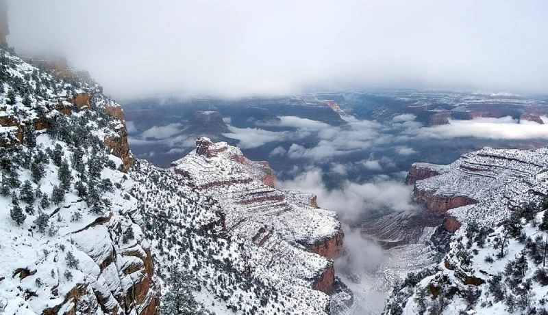
Table of Contents
Overview of the approaching winter storm in Northern Arizona
A winter storm is set to hit Northern Arizona in the coming days, bringing with it the potential for heavy snowfall, ice accumulation, and low visibility. This storm is expected to bring significant disruptions to travel and daily life for residents in the affected areas.
On Saturday, a winter storm warning was issued for Flagstaff. Winter weather advisories were in effect for several other regions in Northern Arizona, including the Coconino Plateau, Yavapai County Mountains, Northern Gila County, White Mountains, and the Chuska Mountains. These areas were advised to prepare for heavy snowfall, ice accumulation, and low visibility.
In Northern Arizona, between Saturday night and Sunday, 8 to 12 inches of snow were predicted to fall. On Saturday night, snow levels will be between 6,500 and 6,500 feet, and on Sunday, they will be between5,000 and 6,500 feet. By Tuesday evening, the National Weather Service predicts that Flagstaff will have between 2 and 3 feet of snow.
“Be prepared for additional heavy snow, gusty winds, very cold temperatures and periods of difficult to impossible travel”
The weather service said in a Saturday afternoon tweet.
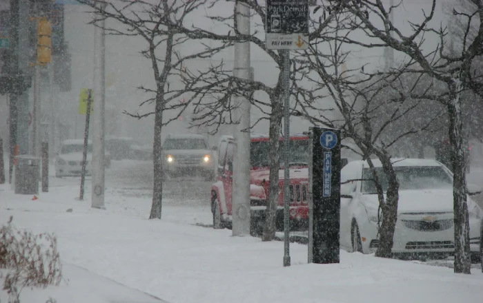
This storm has the potential to bring significant snowfall and ice accumulation, which could lead to dangerous travel conditions on the roads. The National Weather Service has issued a advisory for the affected areas and urges residents and travelers to take necessary precautions.
In addition to the snow and ice, the storm is also expected to bring low visibility and dangerous wind chills, making it important for residents to take appropriate measures to protect themselves from the cold.
Explanation of the weather system causing the storm in North Arizona
The winter storm currently approaching Northern Arizona is being caused by a weather system known as a “cold front.” A cold front is a boundary separating a mass of cold air from a mass of warm air. As the cold front moves in, it pushes the warm air out of the way and brings with it colder temperatures and precipitation.
In the case of the approaching storm, a cold front is moving down from Canada and will be interacting with moisture from the Pacific Ocean, leading to the formation of a winter storm. The storm will bring a mixture of snow and sleet, with the heaviest precipitation expected in the higher elevations of Northern Arizona.
The cold front is also expected to bring strong winds, which will lead to blowing and drifting snow and reduced visibility. The National Weather Service has issued a warning for the affected areas, as the combination of snow and strong winds could lead to dangerous travel conditions.
It’s important to note that this type of weather system is not uncommon during winter months and is a result of the jet stream moving southward, bringing colder air and precipitation to areas that are normally mild.
Weather forecast
i. Expected snowfall and ice accumulation in specific regions of Northern Arizona
The winter storm currently approaching Northern Arizona is expected to bring significant snowfall and ice accumulation to specific regions and communities in the area. According to the National Weather Service, the highest snowfall totals are expected in the higher elevations of Northern Arizona. These areas could see up to 8 to 12 inches of snowfall during the storm.
Lower elevations in Northern Arizona, are expected to see less snowfall as compared to high altitude areas. However, these areas will still be affected by the storm and could see significant ice accumulation on roads and sidewalks.
b. Timing of the storm’s arrival and duration
The winter storm currently approaching Northern Arizona is expected to move into the region on Sunday. According to the National Weather Service, the storm will begin with a period of rain, which will quickly transition to snow and sleet as temperatures drop.
In high country areas, between Saturday night and Sunday, 8 to 12 inches of snow were predicted to fall. On Saturday night, snow levels will be between 6,500 and 6,500 feet, and on Sunday, they will be between5,000 and 6,500 feet. By Tuesday evening, the National Weather Service predicts that Flagstaff will have between 2 and 3 feet of snow.
The heaviest precipitation is expected to occur during in the White Mountains at 11 p.m. Saturday and will last until 8 a.m. Sunday. The storm is expected to bring multiple rounds of precipitation, with the potential for additional snowfall and ice accumulation through the duration of the storm.
Travel impact
i. Possible road closures and travel restrictions
The Arizona Department of Transportation (ADOT) is preparing for the storm by pre-treating roads with de-icing chemicals and have additional plows and equipment ready to clear roads. However, if the storm brings heavy snowfall and ice accumulation, it could still make some roads impassable. In such cases, ADOT may close certain roads to ensure the safety of drivers.
Travelers are encouraged to check the website https://azdot.gov/ for the latest information on road closures and travel restrictions. ADOT also has a mobile app available for download, which provides real-time information on road conditions and closures.
ii. Potential delays and cancellations for public transportation and flights
The National Weather Service in Flagstaff has warned that hazardous travel conditions are expected to begin Saturday night. It may last until Tuesday in the upper northern and eastern parts of the state, due to heavy snowfall, ice accumulation, and low visibility. Whiteout conditions are also expected to occur through midday Sunday. It will make travel particularly dangerous. It’s important for residents and travelers in affected areas to stay informed about the storm’s progress and take necessary precautions.
“The impacts we’re really focusing on for this upcoming winter weather is hazardous travel Saturday through Tuesday, with particularly difficult driving the late Saturday portion through early Sunday.”
Paige Swenson, Meteorologist, National Weather Service in Flagstaff
Public transportation providers, such as buses and trains, may experience delays or cancellations due to the storm. Travelers are advised to check with their transportation provider for the latest information on their plans and schedules, and to consider alternative means of transportation if their plans are affected.
Air travel may also be impacted by the storm. Airports in Northern Arizona, such as Flagstaff Pulliam Airport or Mogollon Airpark, may experience flight delays or cancellations due to the storm. Travelers are advised to check with their airline for the latest information on their flight plans and to arrive at the airport early in case of any delays. It’s also a good idea to have a contingency plan in case of any disruptions to your travel plans.
iii. Warning for potential power outages and other infrastructure disruptions
power outages. In addition, strong winds can cause trees to fall and damage power lines, causing widespread outages.
Residents and travelers in affected areas are advised to prepare for power outages by having backup plans in place. This includes having backup generators, flashlights, and extra batteries on hand. It’s also a good idea to have a supply of non-perishable food and water in case of prolonged power outages.
“It will be tricky to keep everything plowed”
Paige Swenson, Meteorologist, National Weather Service in Flagstaff
The Arizona Department of Public Safety suggests keeping the following items in a winter weather emergency supply kit. It is good to be prepared for potential winter weather hazards. Check list below:
- Cellphone and charger
- Water
- Winter clothing and blankets
- Prescription medication
- First-aid kit
- Flashlight with extra batteries
- Ice scraper
- Small bag of sand or cat litter for wheel traction
- Compact shovel for snow removal
- Travel tool kit and battery cables
- Safety flares
- Non-perishable snacks
- Road map
It’s important to be prepared and have a plan in case of emergency during a winter storm. Keeping these items in your car or at home can help you stay safe and comfortable.
Safety advice

i. Recommendations for safe travel during the winter storm, including suggested routes and emergency preparedness
To ensure safe travel during the winter storm approaching Northern Arizona, the following recommendations are suggested:
Plan ahead:
Check the weather forecast and road conditions before embarking on any trip. Avoid non-essential travel if adverse conditions are expected.
Use suggested routes:
The Arizona Department of Transportation (ADOT) recommends using the main highways and interstates as they are typically cleared more frequently. Check the website https://azdot.gov/ for the latest information on road closures and travel restrictions.
Slow down:
Snow and ice on the roads can make driving conditions hazardous. Reduce your speed and increase your following distance to allow for more time to react to unexpected situations.
Be prepared:
Make sure your vehicle is equipped with winter tires or chains, and carry a winter emergency supply kit with items such as a blanket, water, snacks, and a flashlight.
Have a communication plan:
Have a plan for staying in touch with family and friends during the storm. Make sure to have a charged phone and a way to charge it if the power goes out.
Know what to do in case of emergency:
Have a plan for what you would do in case of an emergency while on the road. Make sure you have a way to call for help, such as a phone or a personal locator device.
ii. Information on available resources for those stranded or in need of assistance during the storm
During the winter storm, it’s important for residents and travelers to have access to resources in case they become stranded or in need of assistance. The following resources are available for those affected by the storm:
Emergency services:
Dial 911 for emergency services, such as medical assistance or to report a road closure.
Roadside assistance:
The Arizona Department of Transportation (ADOT) provides a free roadside assistance program for stranded drivers. The program can be reached by dialing 511 and pressing “0” for operator assistance.
Warming centers:
Local communities may open warming centers for residents who lose power or heat. Contact your local emergency management office for information on warming centers in your area.
Shelters:
Local communities may open shelters for residents in need of a place to stay during the storm. Contact your local emergency management office for information on shelters in your area.
Food and supplies:
Local communities may provide food and supplies for residents in need. Contact your local emergency management office for information on available resources in your area.
Traveler information:
The Arizona Department of Transportation (ADOT) provides real-time information on road conditions and closures on their website https://azdot.gov/ and their mobile app.
Stay informed and take necessary precautions during the storm.
According to the National Weather Service, the conditions are expected to improve starting Wednesday and Thursday of next week, however, lingering showers could persist through the end of the week. It is important to stay informed of the weather forecast, and take necessary precautions.
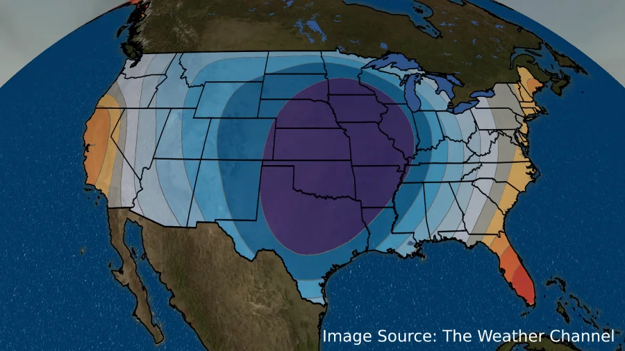
Rain and Cooling Trends on the Horizon for Phoenix and Southern Arizona Region
Southern Arizona and Phoenix will experience rainfall and temperatures lower than average. It will run throughout the weekend and persisting on and off through Wednesday. The National Weather Service warns that residents in lower desert regions. It is expected to see water flowing in normally dry washes and potential flooding in low-lying roads. Swenson, the National Weather Service meteorologist, advises people to take necessary precautions and stay informed of the weather forecast.
“This can definitely still lead to difficult traveling conditions, especially if you’re on any dirt roads or unpaved roads in general”
Paige Swenson, Meteorologist, National Weather Service in Flagstaff
The National Weather Warning Service in Phoenix has forecasted that a second winter storm will hit Phoenix and Tucson on Monday. It will bring cooler temperatures that persist throughout the week. The storm is expected to start on Monday. Storm will continue to bring cooler temperatures until Wednesday.
“Most lower desert locations will have highs in the 50s on Tuesday”
Weather Service, Arizona
Dry conditions may return to the lower desert regions starting Thursday. However, temperatures will remain cool with lows in the 30s which are expected to be colder than last week. The National Weather Service advises residents to stay informed of the weather forecast and take necessary precautions.
Frequently Asked Questions
The winter storm is expected to move into the region on 14 Jan 2023. The heaviest precipitation is expected to occur during the night hours, with the storm continuing through the week.
The winter storm has the potential to affect all areas of Northern Arizona, with the heaviest precipitation expected in higher altitude regions.
Residents and travelers in Northern Arizona should expect heavy snowfall and ice accumulation, which can make roads impassable and cause power outages. Strong winds and low visibility can also make travel difficult and dangerous.
The Arizona Department of Transportation (ADOT) is preparing for the storm by pre-treating roads with de-icing chemicals and have additional plows and equipment ready to clear roads. However, if the storm brings heavy snowfall and ice accumulation, it could still make some roads impassable. In such cases, ADOT may close certain roads to ensure the safety of drivers. Travelers are encouraged to check the website ADOT website for the latest information on road closures and travel restrictions.
Emergency services, roadside assistance, warming centers, shelters, food and supplies, and traveler information are available for those affected by the storm. Contact your local emergency management office for information on available resources in your area. If you are in emergency situation, always dial 911.